

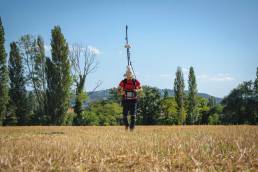
Magnetometry
POTENTIAL METHODS
Magnetometry

Magnetic prospecting is a noninvasive geophysical technique that measures the Earth's magnetic field and its local variations, called magnetic anomalies.
These anomalies are caused by objects or structures with high magnetic susceptibility, such as rocks, archaeological remains, war devices, or buried infrastructure. Magnetic susceptibility is the ability of a material to become magnetized in the presence of an external magnetic field, generating a secondary field that alters the natural field. Magnetometers detect these perturbations, allowing, from the analysis of the shape and amplitude of the anomalies, objects of different nature and size to be recognized, making magnetometers useful tools in a variety of fields: geology, archaeology, war reclamation, engineering, and the environment.
Fields of Application:
Regional and local mineral prospecting
Petroleum prospecting
Geothermal prospecting
Water prospecting
Archaeological research
Fields of Application:
Regional and local mineral prospecting
Petroleum prospecting
Geothermal prospecting
Water prospecting
Archaeological research
Discover the other potential methods:
We are able to offer our partners multiple solutions in the field of Potential Investigations. Discover how we can meet your needs.


Gravimetry and Microgravimetry
POTENTIAL METHODS
Gravimetry and Microgravimetry

The gravimetric method is based on the analysis of spatial variations in the Earth's gravitational field caused by density anomalies and heterogeneities in the distribution of masses in the subsurface.
Classical gravimetry is mainly used for the analysis of large volumes and for the study of regional geological variations, such as sedimentary basins, deep faults, or tectonic structures. In the more detailed domain, microgravimetry represents a high-resolution methodology aimed at detecting small-scale structures, due to its sensitivity to slight density contrasts.
Gravimetric data are represented through profiles or Bouguer anomaly maps, and are subject to complex corrections to eliminate the disturbing effects of topography, solar and lunar tides. The high instrumental sensitivity makes the gravimetric method, and microgravimetry in particular, an effective survey tool for non-invasive study of the subsurface in numerous application areas.
Fields of Application:
Regional and local mineral prospecting
Oil prospecting
Hidden cavity exploration
Hydrogeological research
Fields of Application:
Regional and local mineral prospecting
Oil prospecting
Hidden cavity exploration
Hydrogeological research
Discover the other potential methods:
We are able to offer our partners multiple solutions in the field of Potential Investigations. Discover how we can meet your needs.