


M.A.S.W.Seismic investigation
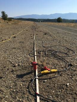
The M.A.S.W. method (Multichannel Analysis of Surface Waves) enables the reconstruction of a vertical velocity profile of sheer waves (Vs), through the acquisition of Rayleigh and Love surface waves, recorded by a series of geophones along a linear stringing and connected to a common multichannel seismograph. Surface waves are easily generated by a seismic source, like a beating sledgehammer. Acquisition can occur with vertical energisation and the use of vertical geophones (ZVF), or with transverse energisation, using horizontal geophones (THF).
fields of application:
Definition of Vs, eq
Definition of Soil Classification
Modelling and study of Local Seismic Response
Seismic Microzoning
Study of landslides

Seismic refractioninvestigation
Seismic refraction prospecting is a survey methodology for measuring how long elastic waves (P and S waves), generated at a source point, take to reach receivers (geophones), arranged along the surface of the land and aligned with energisation points. Distances between geophones and energisation points are established according to the thickness and types of material under investigation. In this way, the velocity of propagation of P and S waves and the thickness of layers crossed by them can be measured.
The principle is based on the hypothesis that the subsoil consists of a limited number of flat/parallel surfaces, each characterised by a constant seismic velocity, both vertically and laterally, and that velocity increased with depth.
fields of application:
Study of subsoil stiffness through the measurement
of the velocity of P and S waves
Analysis of the anelastic attenuation of material under investigation
Determination of the Q quality factor and relative
geophysical/geomechanical characterisations
Determination of dynamic modules of terrains
Lithostratigraphic research
Tectonic/ structural research
Hydrological research
Study of landslide movements
Geological cartography
Geological modelling
Seismic reflectioninvestigation
Seismic reflection prospecting is more complex than refraction seismic surveying, in terms of execution, data analysis and interpretation. It is a sophisticated surveying methodology used for reconstruction, as it provides higher resolution and greater depths of the stratigraphic structure of the area under investigation, for the detection of lateral lithological variations and study of geological structures like folds, faults, oil traps and profound instabilities. It is the most widely used geophysical prospecting method by the oil and geothermal industries, for exploring the subsoil.
The use of this geophysical surveying technique, for the purpose of defining acquisition parameters, like the length of recording, sampling intervals, the distance between geophones, the type of stringing, far-offset or near-offset (to name but a few), shows just how crucial it is for us to be aware of “what we want to do”, which leads to “what we need to see it” and in turn “how can we obtain what we need to see it”. While a preliminary assessment of site characteristics and research objectives provides fundamental information on method applicability, nothing can replace the meticulous and expert analysis of field walkaway testing, which provides precious data.
fields of application:
Tectonic investigations
Structural investigations
Lithostratigraphic investigations and reconstructions
Hydrogeology
Analysis of karst phenomenologies
The identification of cavities
Geological modelling
Hydrogeology
Study of landslide phenomena
Seismograms acquired on the field are processed with the use of specialised and high performance software, to obtain the final stack section. The use of ultra-surface reflection techniques involves the identification and definition of the stratigraphic structure of geological bodies (stratification, depositional geometries, discordances, overthrusts, faults, cavities, etc.), of shallow to medium depth (from a few metres to 500 metres deep), and is one of the most effective surveying methods for the reconstruction of morphologies buried under the Earth’s surface.
In any case, the ability to recognise the limits of the method, modify acquisition parameters, change equipment or end acquisition, are all professional characteristics of ours and a guarantee of quality.


Borehole seismic investigation:Down-Hole and Cross-Hole
Borehole seismic surveying is useful for obtaining a detailed seismic stratigraphy of the subsoil and is effective in defining complex stratigraphies in the best possible way.
The purpose of such testing is to determine the propagation velocity of compressional (P) waves and shear (S) waves, within the lithotype under investigation.
fields of application:
Determination of the direct velocity of compressional (P) waves and shear (S) waves
Definition of dynamic elastic modules of materials